TIME ELAPSED SINCE DEPARTURE : 32 WEEKS
DISTANCE TRAVELLED : 15,740 KMS
Firstly, a special thanks and a big cheerio to Manly, NSW locals and friends Dr Bruce Williamson and his lovely lady Ali who combined to help me deal with a nasty infection on my chest after having another skin cancer removed while travelling. All better now although I have to have more of these things cut out of me in the near term. Ugggh.
YORKE PENINSULA
ITALY sits just west of Adelaide. Well, of course not, but until I looked closely at a map of South Australia I never realised that the YORKE PENINSULA is the exact same shape as Italy i.e. a boot! They are even similar in proportion although the Yorke has a fatter toe area. Perhaps it’s a safety boot? I digress. (Sooz: FYI – Leigh has left the Safety industry but the Safety Industry has not left Leigh! 😊) The eastern side of The Boot stares across St Vincent’s Gulf towards Adelaide while the western side looks over the Spencer Gulf towards the Eyre Peninsula. Below it sits Kangaroo Island (which we visited on another trip some 10 years ago or more and thus do not plan to re-visit. Sooz: Although it was a great place and I highly recommend you visit sometime).
MARION BAY
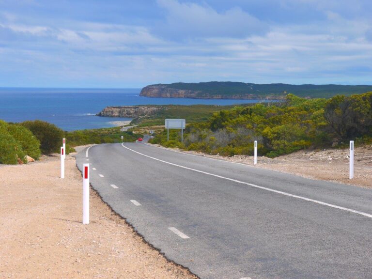
The Yorke Peninsula has a scattering of small towns and is popular with fishermen. At the very bottom lies the town of Marion Bay where we stayed for 5 nights. Only a few kilometres away is the Innes National Park which is quite beautiful with many terrific coastline views. With a clifftop southerly view, far in the distance you can see Kangaroo Island but there are many smaller islands sprinkled around in all directions and some glorious beaches with white sand and that lovely turquoise water. (Sooz: The National Park really is spectacular – we spent multiple days there – we swam in the cold waters, enjoyed the rugged beauty and fished off an historic jetty.) There are large tidal movements and the many fisherman who visit the area mostly chase whiting, tommy ruff, blue swimmer crab and squid. I have never really been a squid fisherman but have started to give it a go with no luck so far. Even Sooz is having a go. The National Park has a population of emus wandering around and, of all things, Mallee Fowl.
On our way to Marion Bay, we passed through a small town called Curramulka where a stop was required. The stop was not pre-planned but while only an hour or so from passing through we learned that there was a ‘Speed Shearing’ competition happening and our curiosity got the better of us. Speed shearing? We had better detour and have a look at this. At the local oval, a rickety stage had been erected where shearers from near and far (Qld & WA) showed off how quickly they could clip the wool from seemingly disoriented sheep. I say that because the animals probably aren’t used to being stripped naked in front of an audience, there would probably not normally be a commentator with a microphone & a bunch of really bad jokes and rock music probably wouldn’t be blaring whilst getting the haircut from a bloke who is trying to get his name on a trophy. So it wasn’t a great day for the sheep. There were lads and ladies and gnarled old veterans competing in various grades and it turned out that a quick sheep haircut took about 45 seconds. We didn’t stay to the end but the fastest we saw was 38 seconds and the slowest was close to two minutes. As in real life, not all the haircuts were good ones. A shearer could be disqualified from a heat should the animal suffer a few too many nicks and I have to say that some of them did look worse for wear after being assaulted by the clippers. A couple of sheep had several nasty, bleeding nicks which wouldn’t have helped their mood. (Sooz: Leigh also commented on the day that the only people who tried to pat the poor, sheared sheep were three year old children and me!)
MOONTA BAY
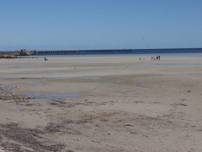
After moving to Moonta Bay where the caravan park we stayed at had a long pier nearby, the attempts at catching squid gathered pace even though no one else was catching them.
But the evidence of previous glories in the form of many squid ink stains on the pier’s planks was overwhelming and next thing you know, Susan is in the local tackle shop with the credit card in her top pocket. An hour or more later, we leave with her clutching her weapon of choice in a new rod & reel and a bag of jigs and swivels and floats etc AND a crab net!. This will ease the pressure off my equipment which is not as extensive as it was a couple of months ago – Sooz’s L-plate style combined with my normal quantity of snags has taken its toll! But losing stuff and getting snagged is all part of the fun. Good on her – she is now all set up with gear and I enjoy her being there with me and as they say, a bad day fishing is better than a good day at work! 😊 (Sooz: I was hoping for a bright pink rod, but only found kiddies rods in pink, and they were just too small. I admit I am happy to be using my own gear and not worrying that I am losing all of Leigh’s tackle. LOL!)
We visited Walleroo which is about 20 minutes north of Moonta and its another fishing town with a large grain shipping terminal and an eccentric museum. Amidst a vast array of maritime and local history paraphernalia spaced out across a rambling array of buildings and sheds sits George, the giant squid in his tank of formaldehyde. George is no spring chicken. He was definitely not caught that week. Matter of fact, George looked rather worse for wear but his size is nonetheless impressive. He is mostly only body and that part of him is about 2 metres in length (Sooz: remember – this is a SQUID) and apparently if he still had his tentacles attached, they would add about 6 meters to his length.
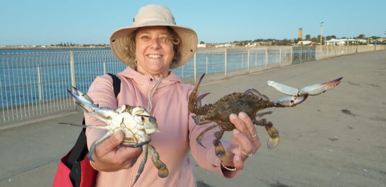
Later that day, Susan’s newly purchased crab trap was christened at the Wallaroo pier and that night we dined on Blue Swimmer Crab pasta! YUM! (Sooz: Catch ‘em, Clean ‘em, Cook ‘em…that’s me!)
(Sooz: Leigh has forgotten to mention that we attended the local footy match whilst in Moonta. We saw the season opener, the Grand Final re-play – the Moonta Devils defeated the CMS crows 175 to 51. That said it was not a bad game. The Devils won as they have some players who are worthy of getting a look in for the AFL.)
BURRA
On the way to the Flinders Ranges we stopped for two nights in a free-camp area called End of the World Gorge. (Sooz: I loved stopping here – it was remote bush camping, a really lovely setting and had clean drop toilets.) This pleasant spot with big ol’ gum trees and a thousand galahs is about 20km outside of historic Burra, on the edge of the Clare Valley wine area. When I say historic, it really is and surprisingly so. Burra has some lovely old stone cottages and public buildings and pubs that date back to the 1840’s. The place was settled by Cornish and Irish miners who were chasing gold and copper and up until the mid 1900’s there was quite an extensive mining industry occurring. Other towns in the area including Auburn and the very pretty Mintaro are similar in their history and abundance of old stone buildings. This gives the whole Clare region a different & unique slant compared to other wine districts (that I have been to in Aust). It’s very charming. We spent a full day poking around the area (Sooz: including historic Martindale Hall which rivals many a country manor in England and a dry, dirt footy oval covered in bindies in Moonta which rivals the gravel oval in Tassie) and concluded with some tastings at a lovely winery that specialised in Rosè, Susan’s favourite libation. (Sooz: favourite next to French Champagne, that is.)
I must add that around 5 km north of Burra on the Barrier Highway that will take you to Broken Hill, sits ‘one of Australia’s most photographed houses’, or so it is claimed. This abandoned old stone cottage lies on a stark hillside and was featured on the cover of Midnight Oil’s “Diesel & Dust” album from the 80’s. Consequently, it is dubbed ‘The Midnight Oil House’. (Sooz: Such an Australian icon of the time – it was pretty cool.)
Speaking of starkness, it is a word that I think aptly describes much of the state of South Australia. You could probably add ‘dry’ to the description. Dry and stark. It becomes evident not long after crossing into it from Victoria. Sometimes the dry starkness could almost be called barren, but more often it is a stark beauty. Thus the term is not disparaging. I keep reminding myself that I am, after all, in the driest state within the driest inhabited continent on the planet.
FLINDERS RANGES
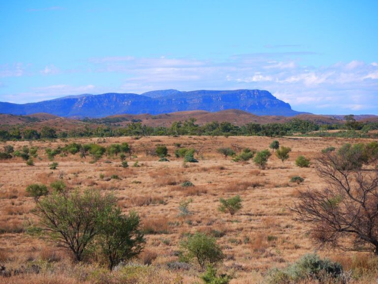
Our next stop was the FLINDERS RANGES and for me, this was a bucket list item. Over the years, I have stared at images of Wilpena Pound and longed to see it in person. This was my chance! The start of the Flinders Ranges was about 3 hours north of Burra and it meant that we were punching into the heart of the nation – and perhaps the closest I have been to the dead centre. There was a certain change to the landscape the closer we got – it became even drier and starker and desert-like but then thin ribbons of green, tree-lined creek beds randomly appeared. Suddenly, way in the distance, the dark ragged shape of much higher peaks appeared and I knew that it was our destination. The drive into this area is dramatic and several road-side stops happened to take quick snaps. (Sooz: The dramatic drive rivals the approach to Carnarvan Gorge in QLD.)
Our first four nights are at Rawnsley Park Station – a 30,000 acre working sheep station but there is not one beast to be seen upon entry – only the fabulous typical outback old red craggy & folded mountains. It was busy. It was Easter after all, but the station allocates some 100 acres to just the camping ground and there is space between sites so that you don’t feel pressed in. There is a classic Australian backdrop to this place. Its part of the western wall of Wilpena Pound and when the sun is setting those old rocks glow with that redness that we are all so aware of.
We took a 120km circuit drive on day two that included Brachia Gorge and stops at viewpoints and ruins of settler houses who had a go at running sheep on this ancient land but failed, as so many have. How old are the Flinders Ranges? It varies. It all depends on which parts you are looking at but there is one viewing point where the range of hills you are looking at dates back anywhere between 500 million years and 1 billion years. It’s all so old and so sunbaked and so grand and beautiful. And the terrain is rocky. There was another roadside stop (dirt road) where embedded in the nearby rocks you were able to see the remnants of the very first forms of marine life which were basically a sludge. There is nowhere else on earth where this is evident but further, here we were some 400 km from the ocean and 1000 metres above sea level. In those ancient days, the place we were standing was under an ocean.
On day three we took a hike from where we were staying that was 11 km return BUT was up to the rim of Wilpena Pound to a viewing spot that looked along the length of this great natural formation. So many people think that it is a giant meteor crater and you cannot blame them, but it’s a sunken valley that is 15 km x 8 km that has typical meteor crater walls. The climb from outside of the Pound, up the walls and to the viewing spot within was one of the most taxing walks I have ever done. There was at least a kilometre of nothing but a very steep rock scramble, but we took it on knowing that the walk was rated ‘difficult’. But so glad we did it! 😊 Lived to tell the tale and I rest easy in the knowledge that if I had waited another 10 years to do this trip, walks like this one may have been excluded from the agenda, or the attempt would have killed me. (Sooz: Leigh scrambled up and down the rocks much more easily than me, as I have a phobia of falling – so vertical rock scrambles are an enormous psychological challenge for me. I am so thankful for the support I received from Leigh – especially on the way down, as no one could have gone any slower than me. Most people would have given up on the wait and just met me at the end.)
There was a bit of disappointment associated with a ‘Gorges and Ancient Rocks’ tour that we did from the Wilpena Pound Park. (We moved to it for 3 nights after 4 nights at Rawnsley Park Station} While it was certainly interesting to see rocks and cliffs that are some of the oldest on the planet and find a plethora of fossils on rocks that used to form part of an ancient sea-bed, it might have been better had our ‘guide’ been able to actually pronounce the names of the various time era’s when the rocks formed, or had some idea of the earth movements that formed mountains and the like. His excuse was that he ‘was not a geologist’. And the $150 per person for the 4-hour bus tour with essential detail missing and with the longest stop being for a cup of tea, it did not seem value for money. The saving grace of the tour was spotting endangered Yellow-footed Rock Wallabies in Brachina Gorge. These wallabies have a spectacular coat of many colours including yellow lower legs and feet and an extremely long tail – striped like a tiger. As there are fewer than 2500 left in the wild, with 2000 in South Australia, it was quite special.
(Sooz: I agree the tour was a disappointment, and I think the resort Is not very well managed. BUT, that said, it was an amazing setting. Just beautiful. The view from our campsite was not quite as magnificent as from Rawnsley Park, but that is the luck of the draw. And hiking into the Pound itself was spectacular. It is a very beautiful, lush oasis in the Ranges. I loved seeing the river beds, with evidence of regular flooding. The bird life was prolific. The scenery was spectacular. It is definitely a special place with a mystical aura.)
START OF THE EYRE PENINSULA – COWELL
Heading back south to tackle the EYRE PENINSULA takes you through PORT AUGUSTA
which is called the ‘crossroads of Australia’ by some. And there is certainly some justification to that nickname. The town has the junction of the two trans-Aust railroad lines – the Ghan that runs from Adelaide to Darwin and the Indo-Pacific that travels from Sydney to Perth. Both pass through here, and as you are driving out of town by road, you have the option at a large intersection to turn right to go to Darwin on the Sturt Hwy or left to go to Perth on the Eyre Hwy. Huh. While talking about Port Augusta, another big thanks to Dave McBryde for mailing stuff to me that I collected from the local post office. If you really want to know what I collected, one of the items was my new ‘NSW Seniors Card’. Oh boy. I am officially old, I guess. Still, I wanted it as it provides us with discounts on some items and every little bit helps when you are undertaking a long trip.
The very sleepy coastal town of Cowell was once a busy and thriving port and prawn harvesting area from its natural sheltered bay. It’s neither of those these days but the local caravan park is loaded with grey nomads who like to carry a tinnie on the roof of their car. The discussions around the caravan park and in the camp kitchen rarely seem to stray from what was biting on the day. We ventured out onto the long pier on a windy Friday arvo to try our luck and Susan landed another Blue Swimmer crab. This will go nicely with the dozen oysters she was able to purchase for $10! The guy who sells them is the local oyster farmer and he actually gave her 14 and then at her request he showed her how to shuck one with the shucking knife she had purchased, and then she ate that one. So that made 15 fresh oysters for $10 (cash transactions only!) (Sooz: Only thing missing was the champagne!)
We were back at the van later that arvo as rain had begun falling and without warning, at precisely 5pm, a loud, wailing siren started. It was like an air-raid siren or bush-fire siren
that some towns have. It droned for about 30 seconds before fading away and it left us looking at each other. What could be the problem? Heavy rain was forecast; was it a weather alert? I went up to the park reception area and inquired if we should be digging a bunker or hiding from the invading Chinese navy or something, but the nice lady laughed and said ‘no, it’s the town siren that sounds every Friday afternoon to signal the end of the working week’. Righto then! And with the inclement weather, all those fishermen were standing around with forlorn looks on their faces and with no idea on what to do.
PORT LINCOLN
PORT LINCOLN at the very bottom of the V-shaped Eyre Peninsula is famous for producing all sorts of things. Firstly, there was the Olympic weightlifter Dean Lukin who no one had ever heard of until he won gold at the 1984 Los Angeles games. I remember when he became a national hero after winning that medal. Then there is Makybe Diva the racehorse that one back-to-back Melbourne Cups and is one of Australia’s greatest race horses. (Sooz: She actually won three in a row and it the only horse to have done so. She was owned by one of the local Tuna magnates.) The town sits on the largest natural harbour in Australia and calls itself the ‘seafood capital’, probably for good reason. It has the largest fishing fleet in the southern hemisphere and supplies vast amounts of Blue Fin Tuna, Kingfish, Abalone, Mussels and Oysters to the world. It has the most millionaires per capita of any town in the country and mostly as a result of the fishing industry. There are a couple of weathered fishing types that you wouldn’t look twice at if they were crossing the road but are worth more than $300 million each and they are Tuna fisherman who provide Japan with the bulk of their catch. (Sooz: it is obviously a prosperous town – unlike many other small towns, it just oozes wealth. There are multiple council approved festivals throughout the year; there is well maintained local infrastructure; and new housing estates being built.) There is also a large grain handling terminal at the port and the town is thus very prosperous with a classic Mediterranean climate. There is even a vineyard on the edge of town. A good portion of the large harbour is National Park with a bunch of campgrounds and I can say that I have never seen sea water that has more clarity. And we spotted any number of seals & dolphins and a million seabirds of all descriptions. (Sooz: We stopped for a cuppa, and some seals came over from a nearby island to check us out – it was pretty cool!)
The only downside? The wind. I have made an observation. Since we hit the southern Victorian coast way back in early December, we have experienced wind. Lots of it. All along the bottom of the country. Wilsons Promontory, the Great Ocean Road, the South Australian coast – it rarely stops bloody blowing! Thus, I am forced to announce that Australia has a Windy Bottom. And this ailment will go untreated. I have a couple of mates with the same issue. Having spent the last 40 years living on Sydney’s comparatively calm Northern Beaches, I personally find the constant wind a bit unpleasant and find myself often cursing it. However a clean, pristine environment exists here in Port Lincoln (Sooz: so much so, that I swam with dolphins only a dozen or so metres away, in crystal clear water – not on a tour!) and I must add that the locals are a very friendly and engaging bunch. To the point where almost everyone waves at you when you are on the road outside of town. It’s like a flashback to driving in the bush in the 1960’s ….. not that I was driving then but I remember my father giving a wave to strangers passing in the opposite direction on country roads. That still happens down here. (Sooz: so this is how Leigh is selling it – he kept asking me if there was something wrong – why are these people waving at me?!)
There are lots of plaques and monuments and references to the navigator and explorer Matthew Flinders across the SA coast. There seems to be far more reference in this state than others which is curious given he circumnavigated the entire country. I have learned of so many places that he named, examples including Port Lincoln, Kangaroo Island, Redcliffe etc and here in SA, there are so many titles in his honour, including the Flinders Ranges, Flinders University, the suburb and shire of Flinders and Flinders street, one of which is also in Melbourne. He was the first person to actually use the name ‘Australia’ rather than Terra Australis as it was previously known.
MARION BAY CARAVAN PARK : 6.5/10 SOOZ: 7/10
MOONTA CARAVAN PARK : 7/10 SOOZ: 7.5/10
END OF THE WORLD FREE CAMP: 6/10 SOOZ: 6.5/10
RAWNSLEY PARK STATION : 8/10 SOOZ: 7.5/10
WILPENA POUND RESORT : 7.5/10
COWELL FORESHORE CARAVAN PARK : 6/10 SOOZ: 7/10
PORT LINCOLN CARAVAN PARK 5.5/10 (t’was a bit shabby, but nice big sites and right on the beach) SOOZ: 5/10
Share this post: on Twitter on Facebook on Google+






Great photos as well, guys! I liked the extra ones on your new photographic page. BTW – The yellow-footed rock wallaby is a genetically distinct sub-species (also classified as Vulnerable under the EPBC Act)
Wow! Sounds fantastic! Room for one more (your MIL) on your adventure?💕 🦘🐨
Just looks so good!
Love the fishing and crabbing